Sharing your map
When the map is set up the way you want it received, open the settings menu in the workspace header, press Share, and copy the link. Send it however you normally would: email, Teams, an intranet page. Your team clicks it and the map opens on your data, configured the way you left it. The User Guide walks them through what they can do from there.
Choose what the link includes
What this link includes lists what you are about to send. The link always includes the map’s name, its data source and its background layers, so a shared map always opens with something behind the data. The rest of your setup has a tick box each, and unticking one means the person opening the link keeps whatever they already had for that setting.
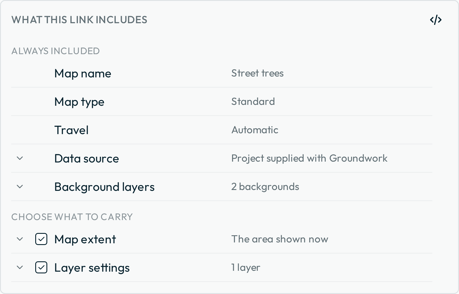
- Map extent. The area you left the map on.
- Layer settings. Your title, category, description, label, status and style choices, including a symbol you set yourself.
- Filters. The values you have narrowed the layer to.
- Active layer. The layer whose features fill their panel.
- Location. The point you have set, the one box that starts unticked. Tick it only when you deliberately want to send that point.
What a link leaves behind
- Bookmarks belong to the person who made them: whoever opens your link sees every feature unmarked, and their own bookmarks are left as they were.
- Layers from files opened directly on a device have no source for a link to point at, so the dialog names any it’s skipping. Publish that data to a cloud folder if your team needs it.
- Unit preferences (metric or US) belong to the device, so each person keeps their own.
Deciding who can edit
Require sign-in to open is the one control that changes what recipients can do:
- Left off. The link opens for anyone who has it, and the map is view-only. They can browse, search, filter and download; the editing tools don’t appear at all.
- Ticked. Each recipient signs in with Dropbox or Microsoft before the map opens, and the editing tools appear once they have.
The other share choices
- Share as a demo map shows everyone who opens the link the editing tools, with every change local to their device and gone when they reload. Your own map is left as it was.
- Require a location to start opens the link on a dimmed map that asks where the person is before the panel and layers appear: right for a map answering “what applies at this address”. Show the map anyway skips the question, so a device that refuses to share its location never blocks anyone.
- Travel by sets how Nearby measures for whoever opens the link: Automatic, walking, cycling, driving or straight line. None turns routing off for the link altogether; a fresh link with a travel mode chosen gives it back.
Checking the link before you send it
Open the copied link in a private browsing window. Your ordinary browser can’t show you what a link does, because the map is already yours there: you keep the editing tools whether Require sign-in to open is ticked or not, and you’re already signed in. A private window shows the sign-in prompt or the view-only map exactly as a recipient gets it.
Sending an updated link
You don’t need a new link just because the data changed. Groundwork reads the source every time a map loads, so new and updated features show up on their own. A new link is for when the configuration changes: different filters, a different starting area, a different set of field choices. Configure the map again, copy a fresh link, and send it; they open it and their existing copy updates in place, leaving them with one map. A Groundwork update that changes what a link carries is the other reason: a link sent before one reports “This shared link uses an unsupported map format.” instead of opening, and a fresh link from the same map replaces it.
Embedding Groundwork in another page
Give the frame enough room for both the map canvas and the Data panel. A scroll of the page over an embedded map does not zoom it; Ctrl + scroll zooms it. Embedding suits read-only use: editing a map held in a cloud folder needs a sign-in, the sign-in navigates the frame to Dropbox or Microsoft, and whether their sign-in page draws inside a frame at all is theirs to decide. Give your team a full-page link when they need to capture or change data.
Next: Troubleshooting.