Connecting a data source
A map in Groundwork is a connection to one data source, plus the configuration you layer on top. The source is chosen once, when the map is created, and there’s no way to repoint an existing map at a different one: to connect to something else, create another map.
Creating the map
Click the map name at the top of the right-hand panel and choose Create new map. Groundwork opens the workspace page, which offers the demo maps as cards and the sources below as tiles. Pick a tile and complete that source, and the map is created. Close the page before you’ve chosen one and the map is discarded. It is not left half-made.
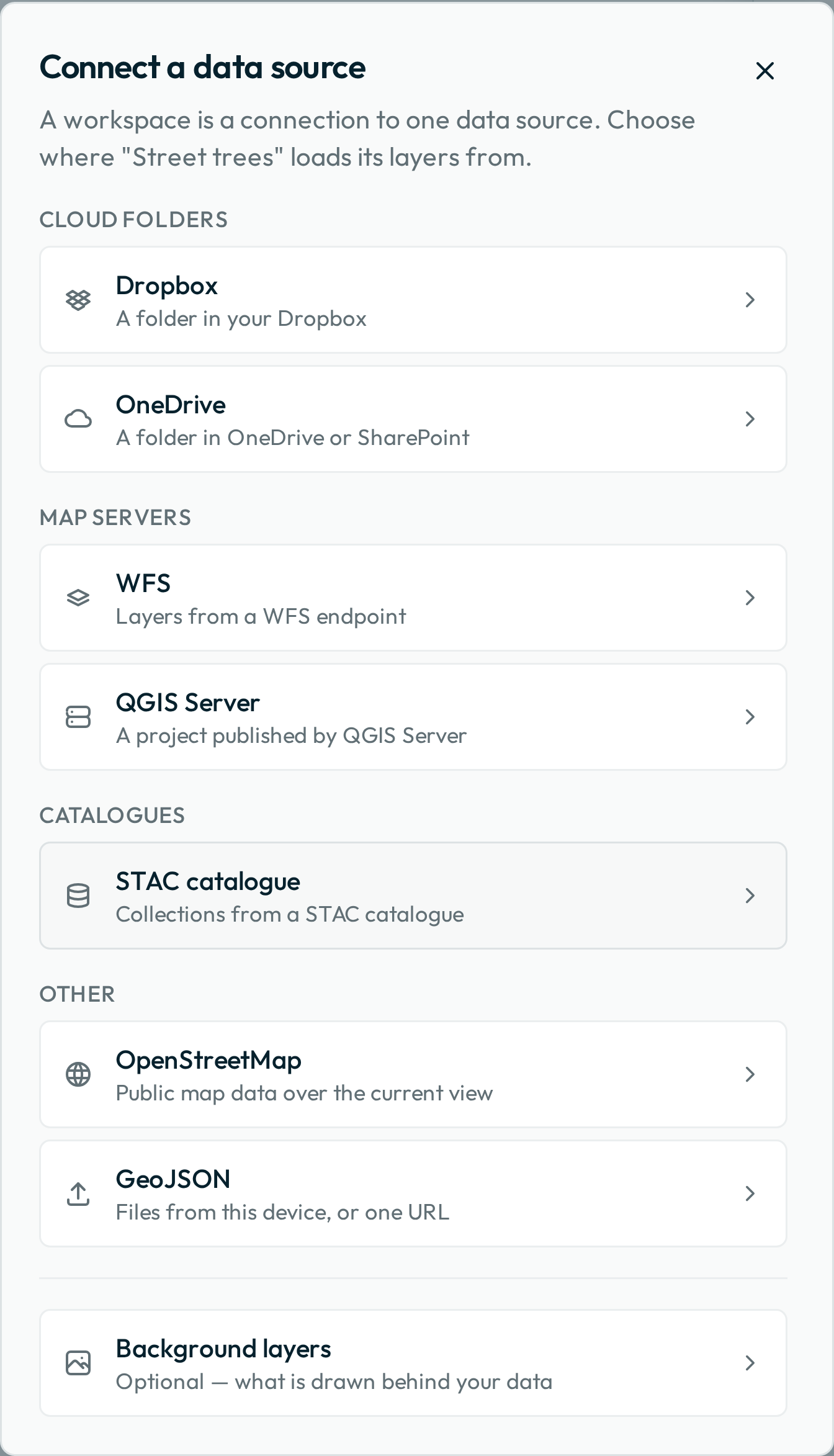
You aren’t asked for a name. The map is called New map until it connects, and then takes its name from what it connected to — the project file for a published folder, the folder name for a GitHub folder published without one, the layer where you added exactly one, the service’s address where you added several. A Dropbox or OneDrive folder published without a project file is named after the share link’s host, because those share links carry no folder name. Rename it whenever you like, from Rename in the Settings menu.
Cloud folders
A folder in Dropbox, OneDrive or SharePoint holding a QGIS project and its data files. This is the source to start with: it needs no server at all, and a QGIS project holds symbology, labels and display fields that a server interface can’t express. Signed-in folder editors can save changes back to the shared data.
Preparing data in QGIS covers authoring the project, and Publishing to a cloud folder the folder layout, the sharing, and what a folder of GeoJSON files with no project gives up.
GitHub
A folder in a public GitHub repository holding a QGIS project and its data files, or a folder of GeoJSON files. Paste the repository’s address, a folder inside it, the .qgs file itself, or a raw.githubusercontent.com address for that file. Nobody signs in, so a public repository opens for anyone with the link.
Changes can’t be saved back to a repository. The editing tools still appear, and Groundwork refuses the save, offering the change as a download instead. Use a Dropbox folder where your team needs to capture data.
WFS
A WFS endpoint. Paste the server URL and Groundwork lists the advertised layers with a filter box, so you can pick several at once. Layers load live from the server, and where the server supports transactions, edits your team makes are written straight back to it. The map reloads exactly the layers you picked each time it opens.
QGIS Server
A QGIS Server project URL, of the shape http://your-server/qgis?map=/projects/street-trees.qgs. Groundwork reads the project’s layers and their styling much as it would from a folder, and reloads the whole current project each time the map opens, so a layer you add to the project later appears for your team without anyone re-creating the map.
STAC catalogue
A STAC catalogue URL. Groundwork lists the collections it advertises and reloads exactly what you picked on each load. A collection that files its data on items inside it opens into those items, newest first, and each item you pick becomes its own layer. The format listed against each entry decides what your team can do with it:
- GeoJSON can be edited, but a published catalogue has nowhere to save those edits back to, so they are stored only on the device that made them.
- GeoParquet shows a padlock and can’t be edited.
- PMTiles and COG are drawn as a picture of the data, with no feature list and nothing to select or edit.
- WFS behaves like any other WFS layer, saving back to its server where the server allows it.
OpenStreetMap
OpenStreetMap imports features for a theme, bus stops or street lamps, say, over an area fixed when the map is created; each load re-imports that theme over it. Only point features are imported, so a park, a cemetery or a school ground drawn as an outline won’t come across. Check what a theme returns before building a map around it.
GeoJSON files
Drop GeoJSON files straight in, click to browse for them, or paste the address of one published on the web. Files can also be dropped onto an open map at any time, whether GeoJSON data, a QGIS project or .sld style files, and they’re added as layers on the spot. Files opened either way are stored only in the browser they were opened in, and a share link can’t include them: see what a link leaves behind. To share this data with a team, publish it to a cloud folder instead.
Background layers
Every map starts with a standard base map and aerial imagery behind your data, and there is nothing to choose: the pair is there from the moment the map is created, and your team switches between them from the control at the bottom of the map.
Next: Preparing data in QGIS, or skip to Configuring the map if your source is already set up.